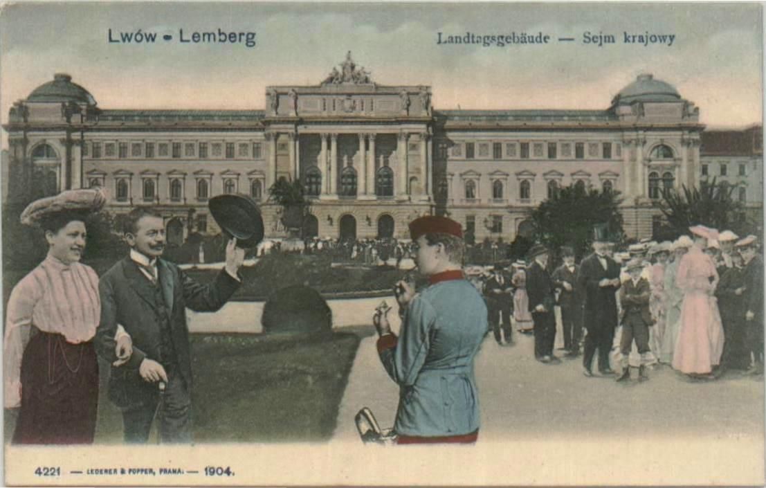
The Seimas of Galicia and Lodomeria in Lviv, built during the Austro-Hungarian rule. After World War I it was converted into the building of the University of Lviv. Photo: postcard from a private collection, Public domain, Wikimedia
Photo: Agricultural Encyclopaedia - Own work, CC BY-SA 4.0, Wikimedia
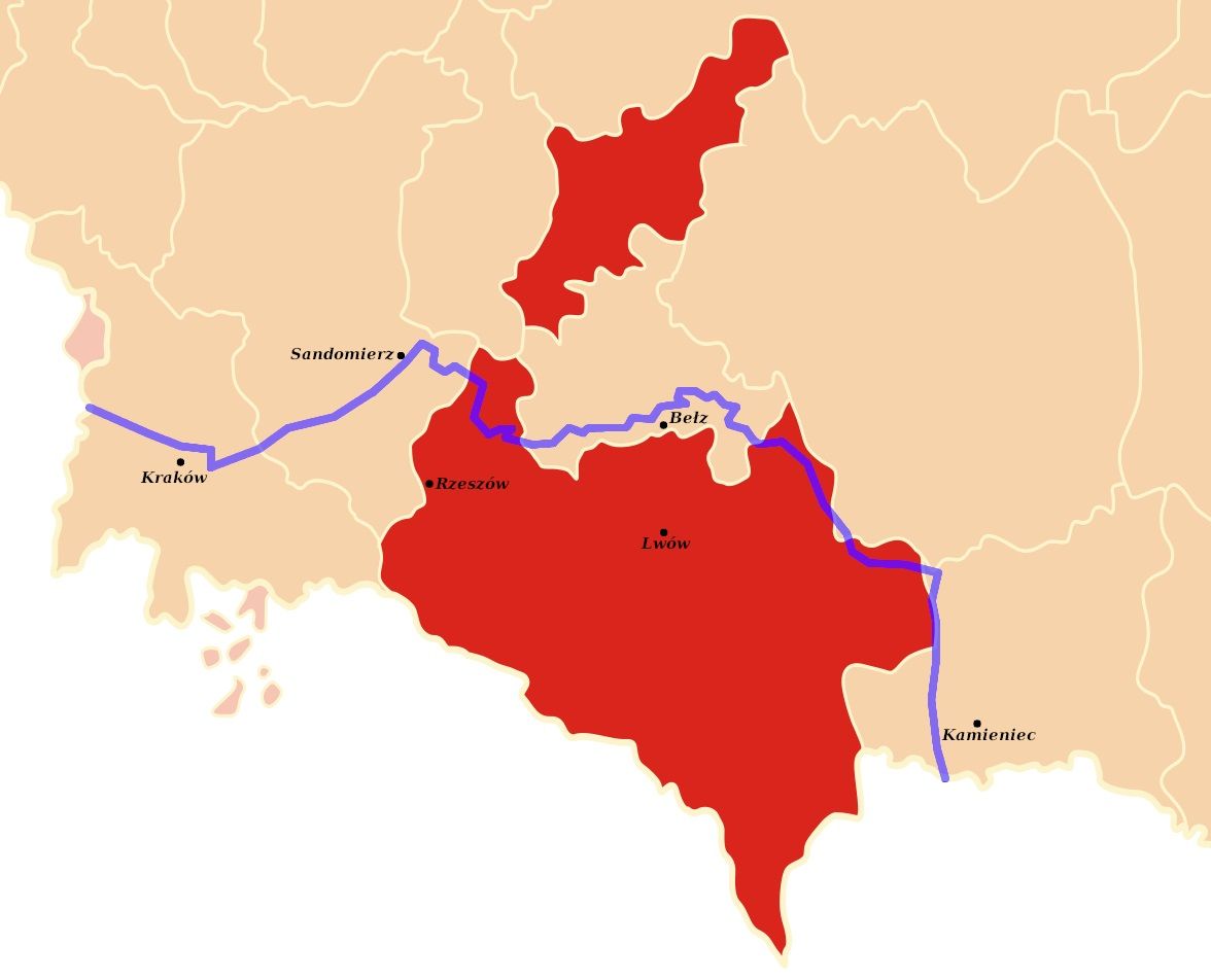
Borders of Austrian Galicia (blue) superimposed on pre-1772 provinces. Photo D T G – Own work, CC BY-SA 4.0, Wikimedia
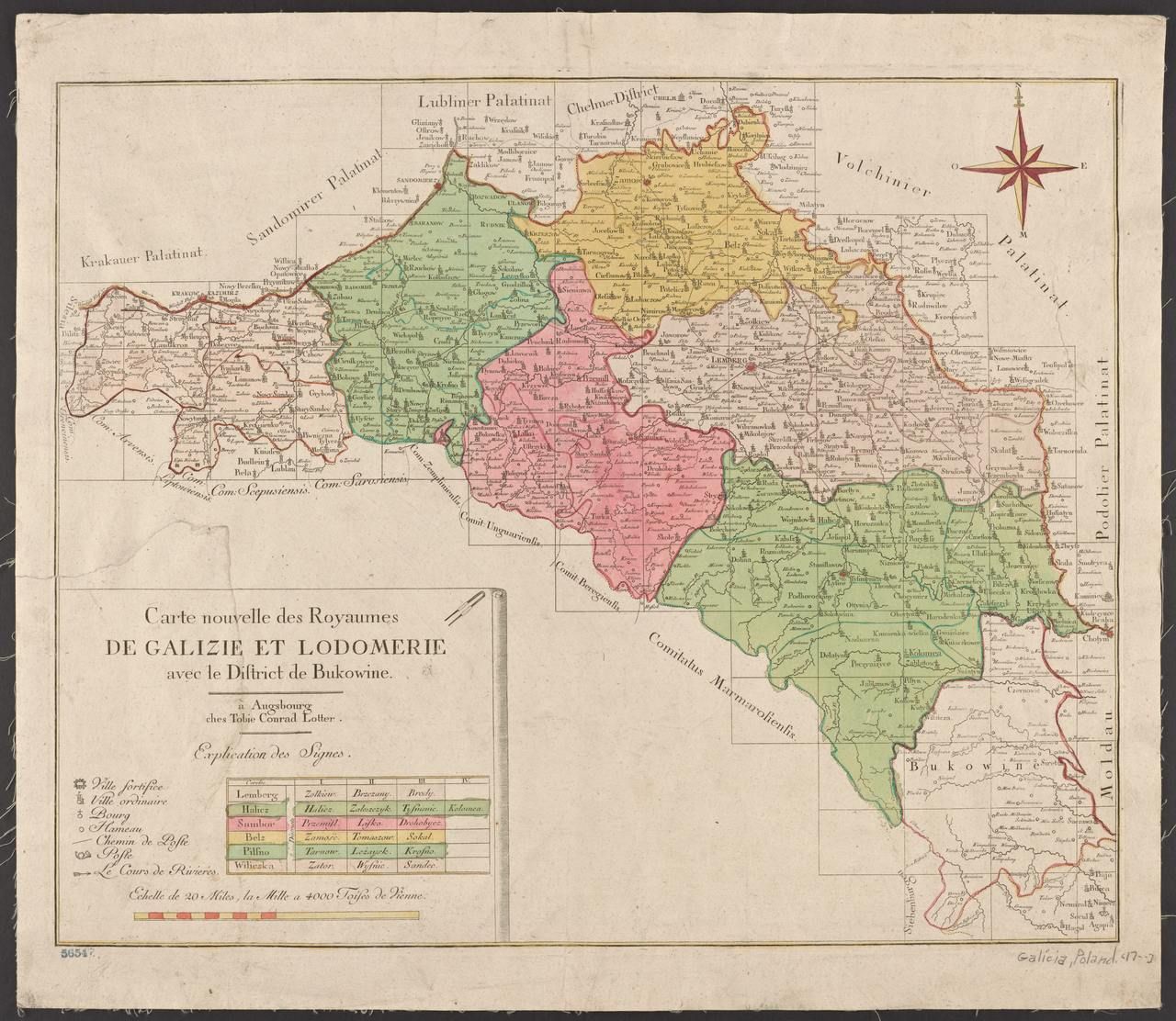
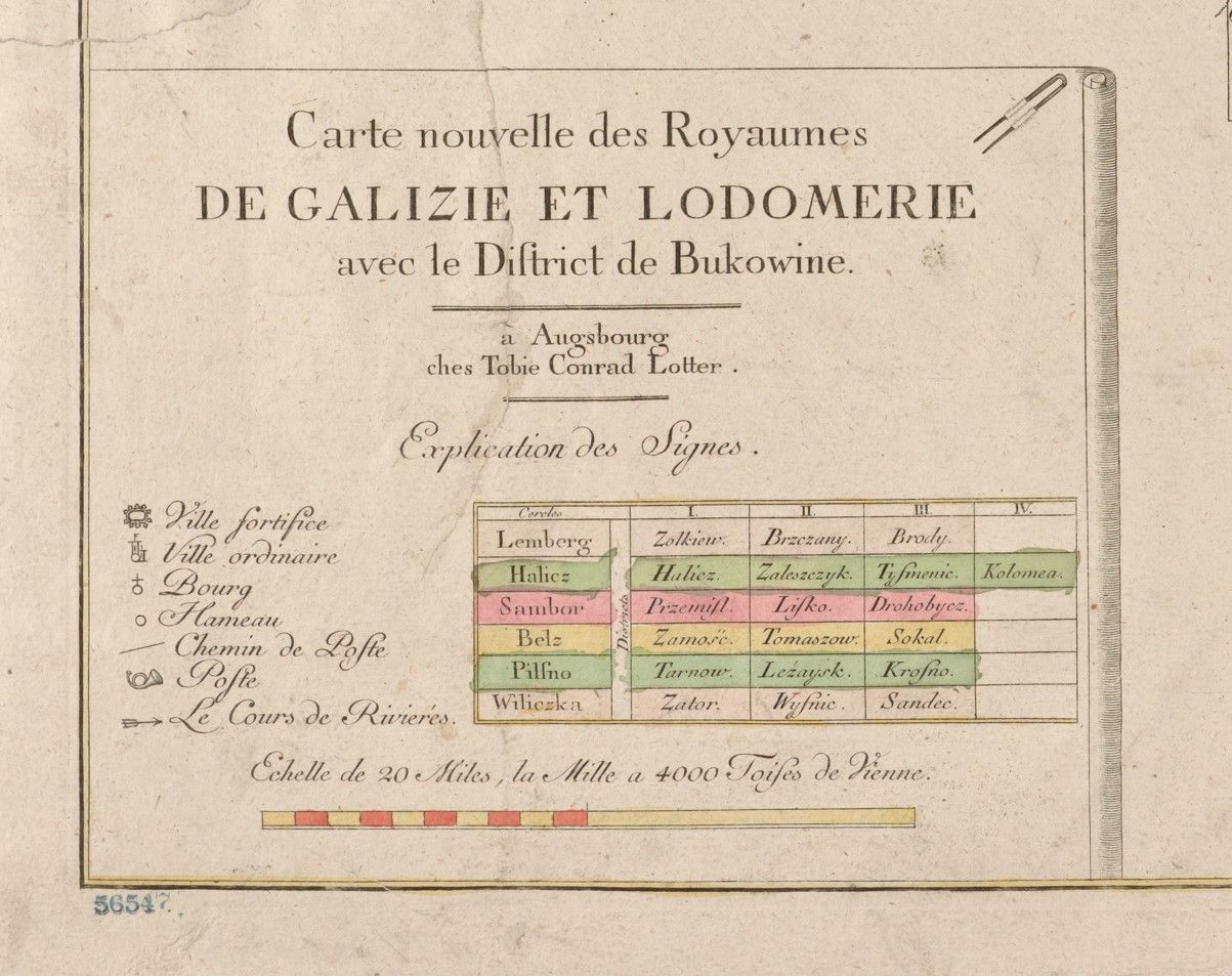
Administrative division of the Kingdom of Galicia and Lodomeria from 1777 to 1782. Map published in the 18th century in Augsburg. Photo: http://report.if.ua/istoriya/biblioteka-nyu-jorka-vyklala-unikalnu-kartu-galychyny-j-bukovyny-18-stolittya-foto/, Public domain, Wikimedia
Legend for the former map. Photo: http://report.if.ua/istoriya/biblioteka-nyu-jorka-vyklala-unikalnu-kartu-galychyny-j-bukovyny-18-stolittya-foto/, Public domain, Wikimedia
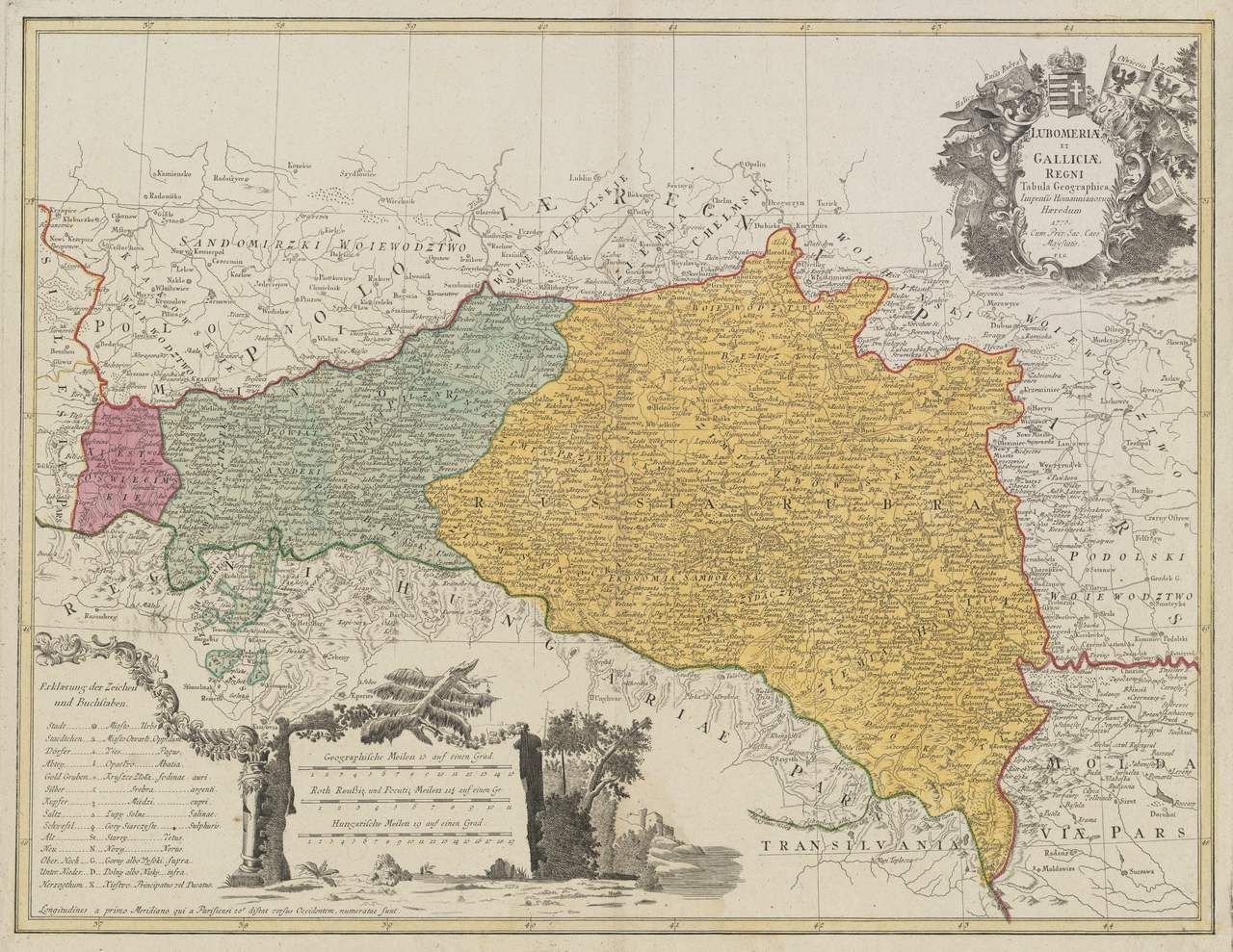
Detailed map of the Kingdom of Galicia and Lodomeria (“Lubomeriae et Galliciae Regni tabula geographica”) with an extract of the estates and deposits, published in Germany (probably in Nuremberg) in 1775. “Cum Priv. Sac. Caes. Majestatis”. Digital maps of the Harvard University Library – Cambridge, Massachusetts. Photo by Franz Ludwig Güssefeld – Harvard Library, Public Domain, Wikimedia
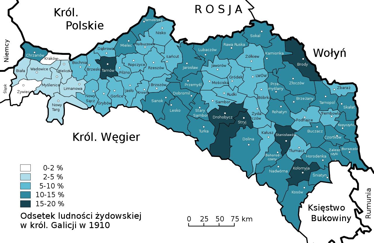
Percentage of the Jewish community in the counties of the Kingdom of Galicia and Lodomeria) in 1910. Source: ANDLAUER, Teresa: Die jüdische Bevölkerung im Modernisierungsprozess Galiziens (1867-1914). Frankfurt am Main : Peter Lang, 2001. photo Furfur, German translation of the original file made by Daniel_Baránek – Own work, CC BY-SA 3.0, Wikimedia
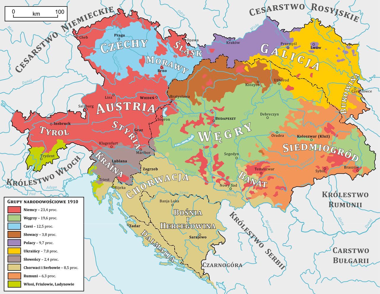
The national composition of Austria-Hungary in 1910. Andrein, Netzach – Own work, based on:Austria Hungary ethnic.svg, CC BY-SA 4.0, Wikimedia
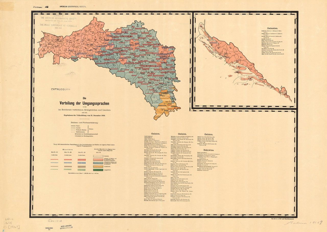
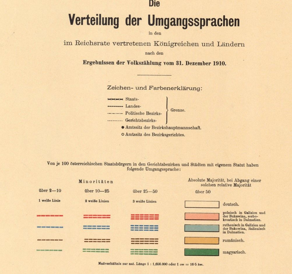
Linguistic map of the Austro-Hungarian dominion – Galicia, Bukovina and Dalmatia – according to the 1910 census. Map of 1916. Photo: K.K. Hof- und Staatsdruckerei (Austria) – https://collections.lib.uwm.edu/digital/collection/agdm/id/12281/rec/17, Public domain, Wikimedi
Legend to the previous language map: areas marked in white – German; pink – Polish (in Dalmatia, Serbo-Croatian was so marked); blue – Ruthenian (in Dalmatia, Italian); orange – Romanian; green – Hungarian. Photo: K.K. Hof- und Staatsdruckerei (Austria) – https://collections.lib.uwm.edu/digital/collection/agdm/id/12281/rec/17, Public domain, Wikimedia
The main road of Galicia (purple line from the west) built by the Habsburgs between 1780 and 1785 to integrate the newly acquired lands. Photo D T G – Own work, CC BY-SA 4.0, Wikimedia
Historical map of railway lines in Galicia. This image is a fragment of a larger map showing the Kingdom of Hungary. Author: most likely Manó Kogutowicz (1851-1908) – Public domain, Wikimedia
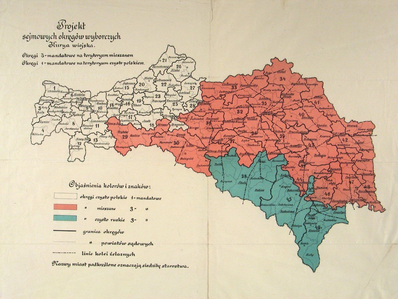
Plan of the electoral law for the Sejm in autonomous Galicia. It divided voters into 4 curiae according to social position, amount of taxed income and occupation. The fourth curia, known as the rural or peasant curia, brought together smaller towns and rural communities. Photo: APKr, Zbiór Kartograficzny, sygn. Zb. Kart. VII-50, Public domain, Wikimedia